
The children with the least choice walk the most
A family with a car can drive around a missing sidewalk. A family without one cannot. Fixing school streets reaches the households with no way around the problem.
Pilot program · Escazú, Costa Rica
Every child's route to class is public infrastructure. In Escazú we measured all 33 of them, street by street, against a standard anyone can check.
Want this for your city? Request itThe pilot street network
Height is a chart, not terrain: taller means a higher overall score.
Drag to pan. Hold ⌘ or Ctrl to zoom. Tap a segment to open it in the platform.
Fail rate and averages are demo figures over real OSM geometry.
Lowest-scoring streets
Demo scores over real geometry. Not real measurements.
Bandera Azul works because the standard is public, the verification is independent, and the seal expires. Escuela Segura is built the same way, on one question: what share of the walk to this school meets Ley 7600? StreetLens measures it from the streets themselves. The seal is awarded by a convening body, not by us.
A family with a car can drive around a missing sidewalk. A family without one cannot. Fixing school streets reaches the households with no way around the problem.
Costa Rica has more than four thousand schools. Escazú is not the goal, it is the template: a standard and an instrument the next canton can adopt without inventing either.
Below 60% of the walk surveyed, a school publishes no score at all. Most of the canton sits there today, and saying so is the point.
We want cities that are cleaner, calmer, and more livable for everyone who moves through them. That does not begin with a bigger plan. It begins with an honest look at the street.
Street quality is not just pavement. It is where infrastructure, daily life, and community intersect, and its condition quietly decides who a city serves and who it leaves behind.
StreetLens is the instrument for that. The method is open and the same rubric applies in any city, so anyone can read a street the same way and check the result. Today the pilot runs on demo data over real geometry, and fieldwork in Escazú begins in August 2026.
Walkability breaks down into parts you can measure. Every segment is scored on four independent rubrics, the same way in any city. Two of them are climate resilience: shade tracks heat exposure, and drainage tracks flood risk. Each ramp is colorblind-safe and paired with a line-width channel, and every legend shows its bins.
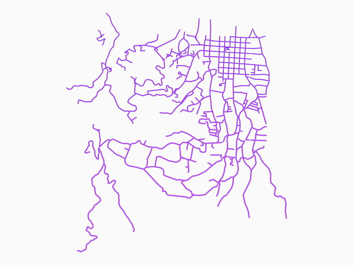
Accessibility
Curb ramps, tactile paving, and safe crossings. Whether everyone can actually use the sidewalk.
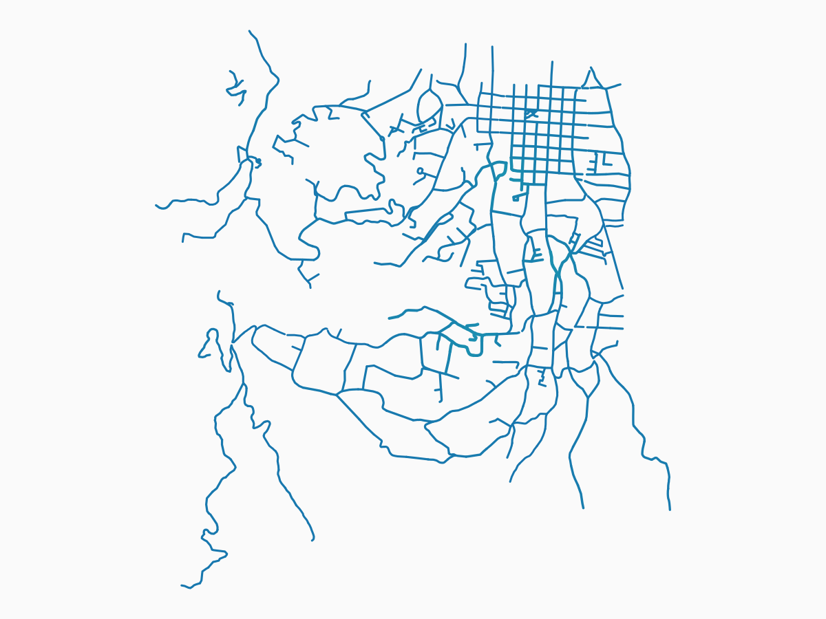
Drainage
Grates, cross slope, and ponding history. From flood-prone to well-drained.
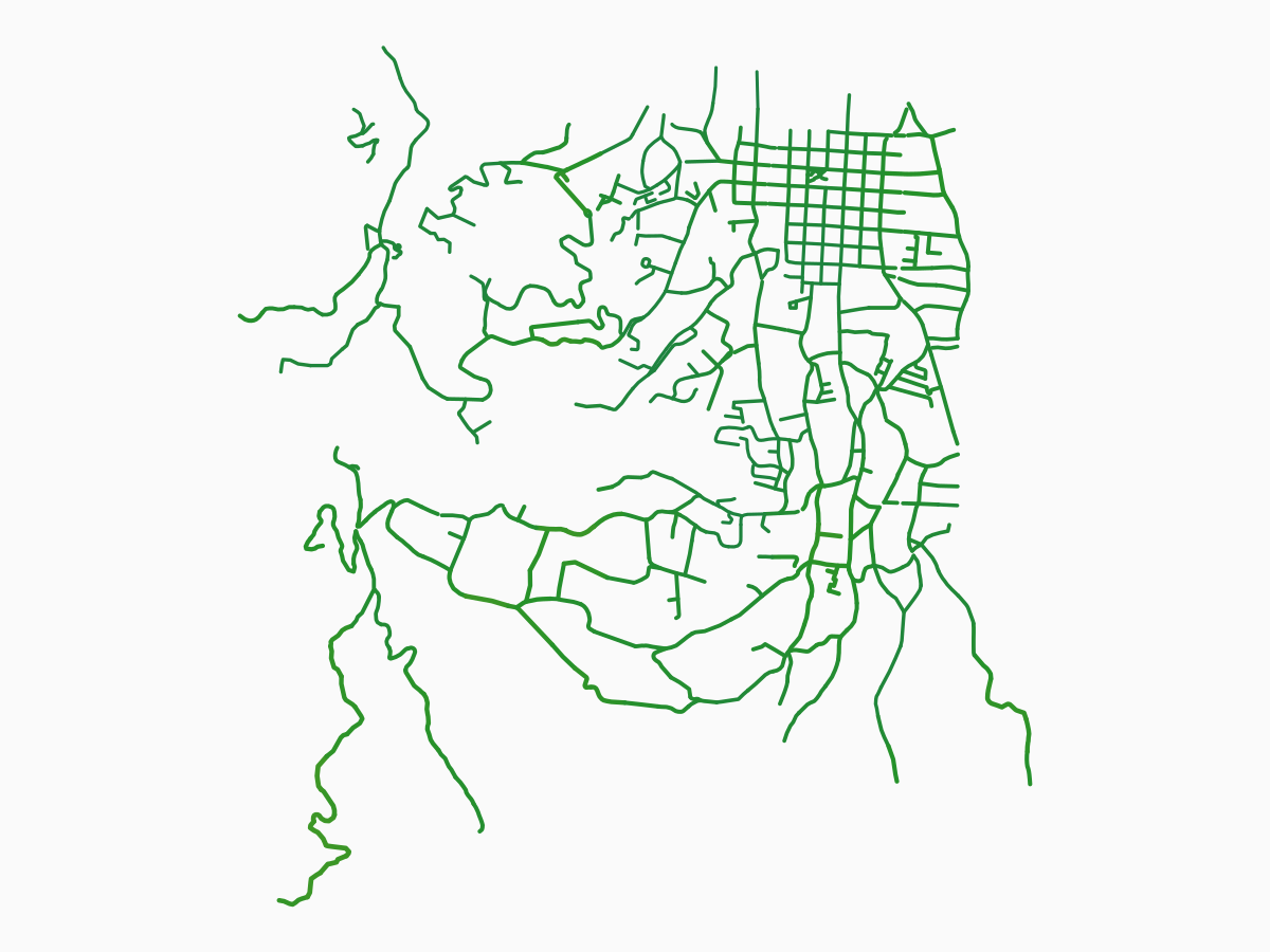
Shade
Tree canopy and cover, and the heat they hold off. From exposed pavement to full canopy.
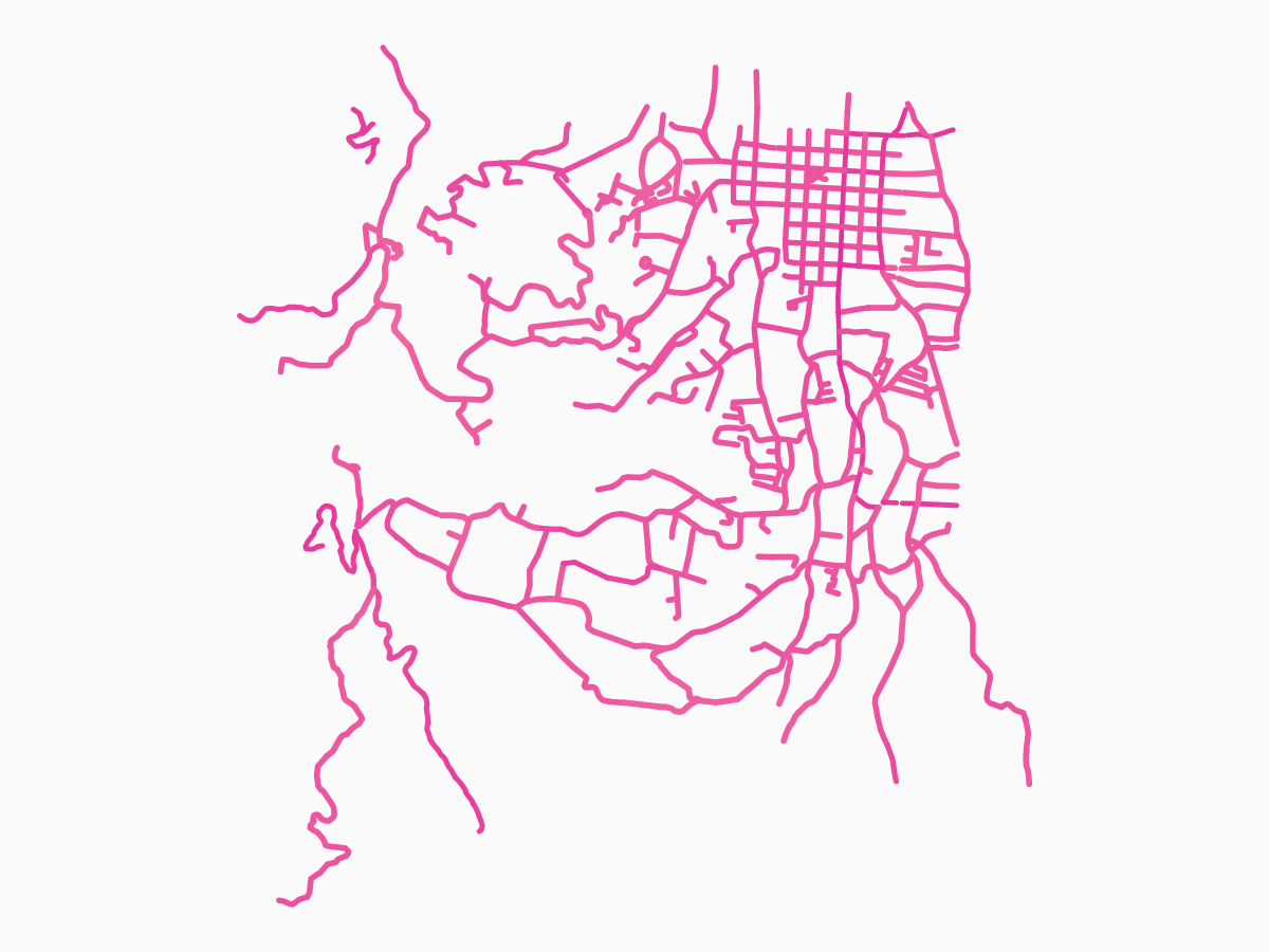
Bike
Bike lanes and separation from traffic. From none to protected.
You cannot budget, fix, or answer for what you never measured. A complete street starts as a measured one, and most cities cannot say which sidewalks fail, or where.
Accessibility, drainage, and shade are almost never measured segment by segment, so they never enter a budget or a work order.1Ley 7600, Costa Rica's equal-opportunity law, has required accessible sidewalks since 1996. No municipality yet publishes a compliance map. The cost of not knowing is not abstract. It is counted in people.2COSEVI, the national road-safety council, publishes Costa Rica's annual road-safety counts.
COSEVI road-safety data.
Ley 7600 took effect in 1996.
Demo figure over real geometry. Not a measurement.
Every instrument needs a first street. Ours is San Antonio de Escazú, mapped segment by segment over real geometry. Field collection begins in August 2026, corridor by corridor.
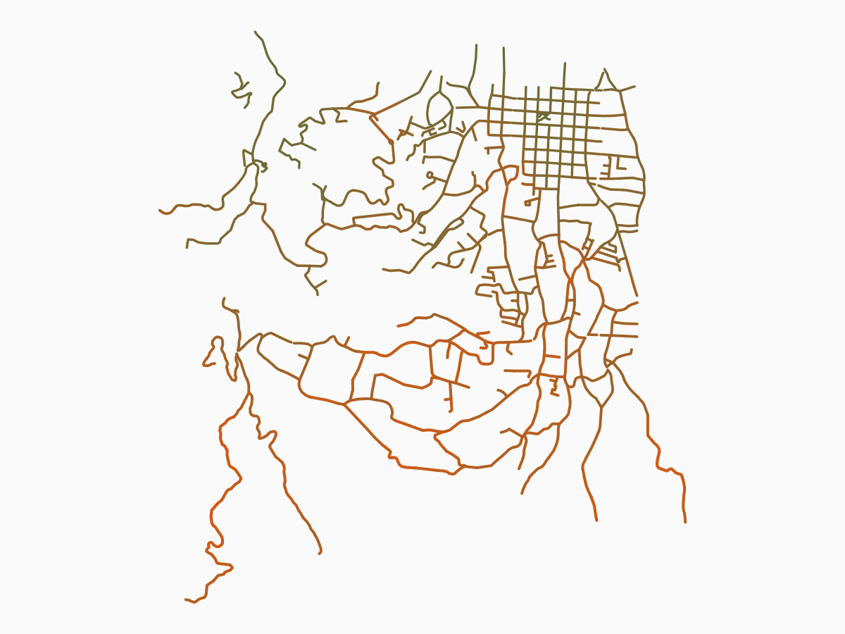
The pilot corridor, mapped in full.
San Antonio de Escazú over real OpenStreetMap geometry. The rest of the canton follows, on the same rubric.
Source: StreetLens over OpenStreetMap geometry. Demo scores until fieldwork begins August 2026.
535
Segments mapped
76.8km
Corridor km
80.3%
Pilot coverage
This is a pilot, and a beginning.
Demo audit over real geometry. No score shown is a measurement until fieldwork begins in August 2026.
Each segment is audited against an established rubric. Nothing is inferred from a desk.
An auditor walks the segment, records each item on site, and the score is computed from those observations.3MAPS-Mini is a validated microscale audit of pedestrian streetscapes: sidewalks, crossings, and buffers. The same instrument runs on any street network, and every number traces back to something a person saw and wrote down.4LANAMME-UCR is Costa Rica's national road-materials laboratory at the University of Costa Rica, the source for pavement and condition standards.
A validated microscale audit of pedestrian streetscapes: sidewalks, crossings, and buffers.
Costa Rica's national road-materials laboratory at the University of Costa Rica, for pavement and condition standards.
Costa Rica's equal-opportunity law, which sets the accessibility minimums a sidewalk must meet.
Every score traces to an on-site observation and, in time, a photo.
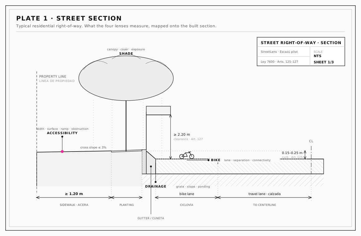
What the four lenses actually read.
A street's right-of-way in section, with the sidewalk, buffer, and carriageway each measured against the rubric above.
Source: StreetLens drawing over Reglamento a la Ley 7600 (Decreto 26831-MP) sidewalk minimums.
Calle Central, San Antonio
73
Overall
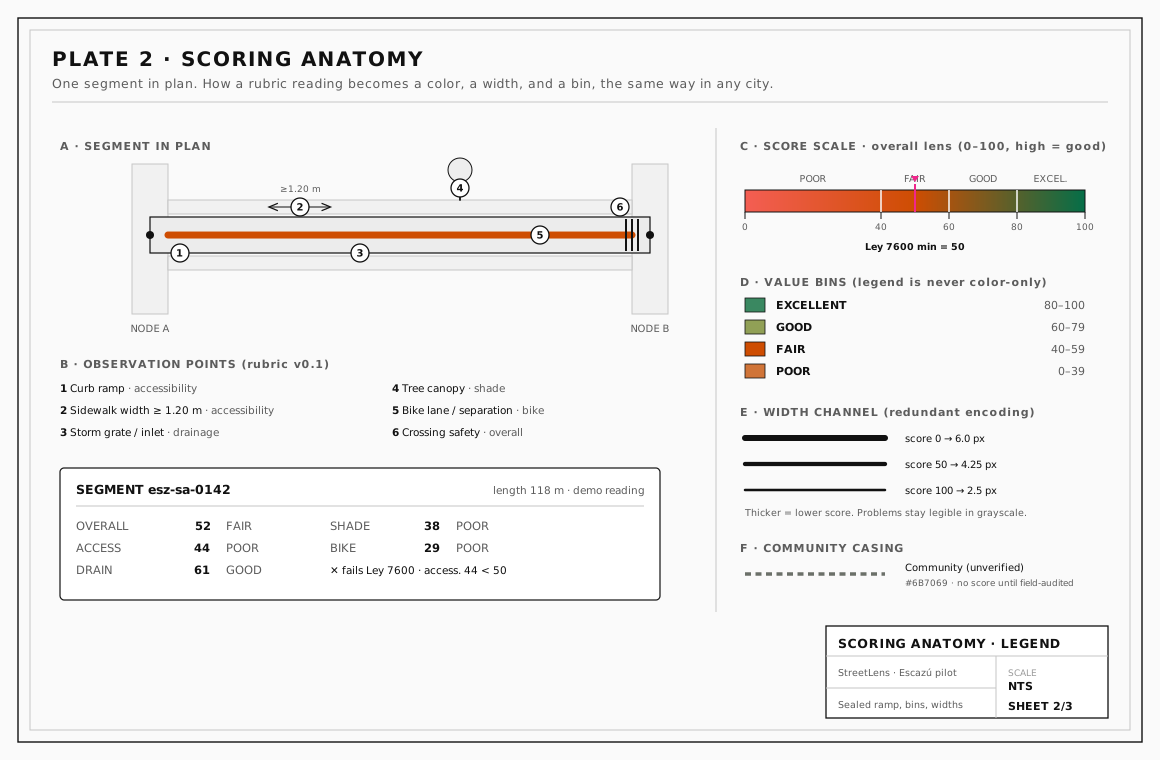
How one segment becomes four scores.
The same segment in plan, with the audit rubric, score bins, width channel, and community casing that resolve to the readout above.
Source: StreetLens scoring schematic. Width bins per Reglamento a la Ley 7600 (Decreto 26831-MP).
How the data is collected
A trained auditor walks a corridor and records the rubric on site. This is the source of truth.
Anyone can add a street we missed or flag a correction from the map. Every submission is reviewed before it changes anything public.
The engine ahead
Field audits remain the source of truth, and they stay that way. Camera walks already propose scores on the map: each session is reviewed before anything goes public, and a person still verifies what it reports. Those walks also become labeled training data so future field audits score faster. A camera proposal is not a field audit until one is published.
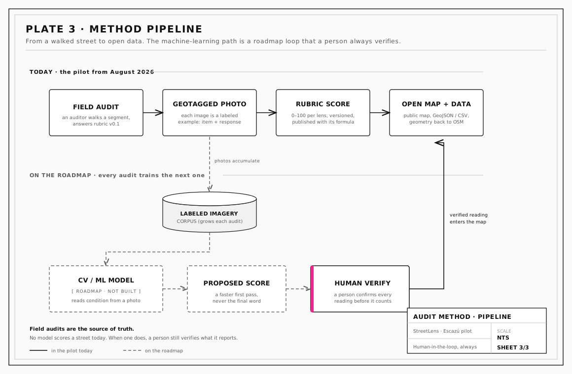
Field audits today. A verified model tomorrow.
Every walked corridor is photographed, and those images become training data for a computer-vision pipeline that a person always checks.
Live today: camera proposals on the map, admin-reviewed. Field audits remain the published source of truth.
StreetLens is not a black box. It leans on established rubrics and open datasets, every score ships with its formula, and the code is public.
Open source
The whole platform is public on GitHub: the code, the rubric, and the scoring method, open for anyone to read, run, or fork.
Open data
Every segment exports with its geometry and its score formula.
The pilot is step one. The instrument is built to scale, from a single corridor to a whole canton, across cantons, and out to anyone who needs the data.
San Antonio de Escazú, mapped over real geometry. Field collection begins August 2026.
Every corridor in Escazú, audited on the same rubric.
Neighboring cantons measured the same way, so results compare directly.
Governments and researchers query the scored network directly.
The street network is real OpenStreetMap geometry. The audit scores you see colored today are simulated demo data, labeled as such wherever they appear, and you can switch them off from the map. Camera-observed and community-reported work is real, and each one is reviewed before it appears. Field audits will replace the demo scores corridor by corridor once published.
Each layer is scored 0 to 100 from a rubric of observed items, where higher is better. The map pairs a colorblind-safe color ramp with a line-width channel, and the legend always shows the value bins. Every score ships with its formula.
Yes, for proposals — not for published field audits. Camera walks already produce proposed scores on the map; a reviewer approves each session before it appears, and those readings stay separate from field audits until one is published. Field auditors remain the source of truth, and a person always verifies what the camera reports.
That is the goal. The rubric, the app, and the data format are open and portable, built to run on any street network. Today only the Escazú pilot is live. If you want to bring StreetLens to your city, reach out through the project on GitHub.
Field collection in San Antonio de Escazú is planned for August 2026. Until then the pilot runs on demo data over the real corridor.
Yes. You can add a street we missed or flag a correction from the map. A reviewer checks every submission before anything on the public map changes.
StreetLens is a project of CUSP, the Collective for Urbanism and Sustainable Progress, led by Gianluca Fonseca. It is open source and built in the open.
The call
Open the live map, or add a street you know. Every score ships with its formula.